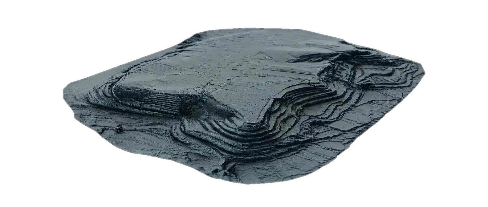
A luxury farm/estate near Kamshet in India was being designed on a very large, topographically complex plot. The client commissioned a LiDAR survey, but the architectural team needed the raw point cloud converted into a precise, lightweight terrain model they could actually design on. I acted as an external geospatial specialist, turning several billion LiDAR points into a single, Rhino-ready 3D site model.
Project Facts
- Client typeArchitectural studio designing a private luxury farm/estate
- LocationKamshet area, India
- YearOctober 2024
- Project typeLarge rural estate with six separate buildings
- My roleExternal geospatial specialist converting LiDAR survey into a design-ready terrain model
- Primary toolsLiDAR point cloud processing, DTM generation, CAD export (DWG/DXF)
01Design Challenge
The estate masterplan depended on getting the terrain right. The plot was large and hilly, and almost every key decision — building placement, access roads, paths and landscape structure — depended on understanding the real topography. The architects had commissioned a third-party LiDAR survey, which delivered four very large classified LAS files (together several billion points). However, the studio did not have the tools or experience to turn this raw data into a clean, workable model for day-to-day use in Rhino.
In their usual workflow, the team would generate a 3D surface from survey contours. On this project, the site was so extensive and the contours were spaced so far apart that this approach would have produced an oversimplified terrain, smoothing away important features. At the same time, the raw LiDAR dataset was far too heavy and complex to handle directly: initial attempts using downloaded software failed because the files were enormous and the tools unfamiliar. They needed someone to bridge the gap between the survey and their design software — delivering a precise but manageable 3D terrain model that would drop straight into Rhino.
02Approach Tailored for Architects
Turning raw LiDAR into a reliable ground surface
The starting point was four classified LAS point clouds, each several gigabytes in size. I first verified the classification and extracted only ground points, so the architects would be working on a true terrain surface rather than roofs, trees or noise. I also checked the georeferencing and coordinate system, ensuring the model would sit correctly in context without extra survey work on their side.
Building design-ready terrain models at different resolutions
From the ground-only cloud, I generated an initial digital terrain model (DTM) at 2 × 2 m resolution. Based on this, I created several versions of the terrain mesh with different levels of detail. The architects could test these directly in Rhino and choose the resolution that felt like the best balance between precision and performance for their specific hardware and design phase.
Merging tiles into one continuous site model
Each of the four LiDAR tiles was first converted into its own DTM. I then merged these into a single, continuous terrain model, carefully cleaning seam lines where the tiles met so there were no visible edges or steps. The result was one coherent 3D representation of the entire plot, which is much easier to read and design on than a collection of separate, overlapping tiles.
Exporting into familiar CAD formats
Once the preferred resolution was agreed, I exported the final terrain into CAD formats the studio uses every day. Despite starting from multi-gigabyte point clouds, the finished files were reduced to approximately 52 MB (3D DWG) and 173 MB (3D DXF). This made the model light enough to combine with detailed architectural geometry, while still retaining the fidelity of the LiDAR survey.
03How the Architects Used the Model
The final 3D model represented the complete site and became the base layer for the project. The architectural team used it throughout the design process to understand the topography, position six buildings, and design roads and pedestrian paths on a realistic representation of the terrain. For a site of this size, the 3D model was described as indispensable: it provided a level of spatial understanding that would not have been possible from contours alone. Although the studio carried out some additional patching and simplification in-house to fit their internal standards, this work built on a correct, continuous LiDAR-based terrain rather than an approximate surface.
04Why LiDAR Made a Difference
In previous projects, the architects typically relied on a 3D surface generated from survey contours. On this estate, the contours were too widely spaced to capture the true shape of the land, particularly for detailed work on platforms, retaining structures and circulation. By starting from a dense LiDAR dataset instead, the terrain model preserved subtle slopes, ridges and depressions that matter when placing buildings and shaping outdoor spaces. This gave the design team greater confidence that decisions made in Rhino would match the reality on site.
05Client Perspective
From the architects' point of view, working directly with raw LiDAR data was not realistic. They described themselves as unequipped and untrained to process point clouds, and early attempts with generic software were unsuccessful. Receiving a ready-to-use 3D terrain model in DWG and DXF completely removed that barrier and allowed them to stay within their familiar Rhino-based workflow. In their words, this type of work sits outside the typical scope and skill set of an architect, and it is more effective to rely on a specialist who understands both LiDAR and the needs of the design team.
06Key Takeaways
- You can use highly accurate LiDAR data on complex sites without changing your core design tools.
- A specialist can deliver a single, continuous terrain model that drops straight into Rhino as DWG/DXF.
- Careful optimisation means you get the precision of LiDAR in a file light enough for everyday design work.
"LiDAR scanning is extremely precise and superior to other forms of surveying. Whenever I am able to convince a client to use LiDAR, I would always choose this method."
— Architect collaborator (private residential estate, India)
Related service
Geospatial Data Processing & AI-Driven Analysis →Interested in a similar project?
Get in Touch