
jps models production
AI-Native Geospatial Intelligence
3D Laser Scanning, LiDAR & Geospatial Data Processing in the UAE & Saudi Arabia
Advanced 3D Modelling, Geospatial Data Processing & AI-Driven Analysis
New: JPS Models is the Authorized UAE Reseller of DMD Navigation – adventure navigation for moto, 4x4 and SSV.
Register interestWho We Work With
We support professional B2B clients who manage complex assets, infrastructure, and construction sites. Our services are tailored to engineering decision-makers who need reliable data, clear models, and defensible documentation.
Architectural Studios & Design Practices
Providing LiDAR-to-design terrain models, point cloud processing, and AI-driven site analysis to support concept-stage planning and landscape architecture.
Construction Companies & Main Contractors
Delivering large infrastructure and earthmoving works requiring dimensional control and AI-processed 3D models.
Civil Engineering, Surveying & Consulting Firms
Needing accurate models, independent third-party QC, dimensional verification, and advanced AI-driven geospatial analysis and BIM model generation.
Infrastructure Operators & Government Entities
Relying on detailed mapping, compliance documentation, and settlement monitoring services.
Our Services
Our work is organised into four primary service lines, all delivered through an AI-native operating model with outsourced data capture and in-house processing, QC, and advisory.

Geospatial Data Processing & AI-Driven Analysis
jps models production applies AI-native workflows to geospatial data processing — from LiDAR-to-design terrain models for architects to production-grade BIM outputs for contractors and consultants.
Learn more →
Land Surveying & Dimensional Control Consulting
Comprehensive third-party quality assurance and dimensional verification services for construction and infrastructure projects across the UAE and GCC region.
Learn more →
Positioning & Control Systems Trading
Supply and advisory services for professional positioning and control systems from established European manufacturers.
Learn more →
Geographical & Topographical Mapping (AI-Enhanced)
Production of detailed topographical and geographical maps leveraging AI-powered data processing and geospatial intelligence.
Learn more →Not sure which service fits your project? Get in touch →
Technology & AI-Native Workflows
We combine multiple capture technologies – including terrestrial and mobile laser scanning, LiDAR, photogrammetry, and GNSS – with AI-driven processing to deliver consistent, production-ready outputs. Data capture is provided through specialist partners, while our focus remains on advanced processing, quality control, and decision-grade deliverables.
LiDAR & Laser Scanning
Terrestrial and mobile laser scanning with AI-powered point cloud processing for millimeter-accurate 3D documentation.
AI Agent Workflows
Proprietary AI agents trained for point cloud classification, feature extraction, change detection, and model validation.
BIM Integration
Integrated workflows for BIM model generation, terrain models, volumetrics, and as-built documentation.
DigPilot Machine Control
Norwegian-engineered 3D machine control for excavators and heavy machinery with multi-constellation GNSS and open design formats.
This AI-native model allows us to deliver high-quality outputs quickly, without the overhead of a traditional large survey team.
Our process
Data Intake
We receive point clouds, scan data, or imagery from your survey team or our partner network, along with design models and tolerance specifications.
AI Processing
Trained AI agents handle classification, filtering, feature extraction, and initial model generation, guided by project-specific parameters.
Expert Review
The founder personally reviews and refines outputs, ensuring dimensional accuracy and alignment with contractual and engineering standards.
Delivery
We validate models, generate discrepancy reports where needed, and prepare deliverables ready for engineering use and sign-off.
About Us
Why work with jps models production
We are an AI-native geospatial firm based in Dubai, combining 10+ years of professional experience in surveying and civil engineering with cutting-edge artificial intelligence to deliver production-grade outputs for construction and infrastructure projects.
AI-native from day one
AI is integrated into our core workflows, not added as an afterthought, enabling rapid turnaround and consistent quality.
Senior-level expertise on every project
You work directly with a civil engineer and geospatial specialist with 10+ years' experience in surveying, dimensional control, and infrastructure projects.
Independent third-party QC
We act as your technical partner, providing objective advice and independent quality control, separate from contractors.
Flexible, partner-driven data capture
By collaborating with established survey and drone partners, we adjust to project needs while keeping our focus on processing, analysis, and advisory.
Equipment and systems insight
Through relationships with European equipment suppliers, we understand both the data and the systems that produce it, from DigPilot machine control to GNSS and laser instruments.

Jacob Slopnicki
Founder, Director & General Manager · MSc Civil Engineering
10+ years in geospatial engineering, surveying, and construction infrastructure projects across multiple markets.
Selected Case Studies
A combination of completed project case studies and relevant experience from the founder's professional track record. New case studies will be added as the company delivers projects under its own name.
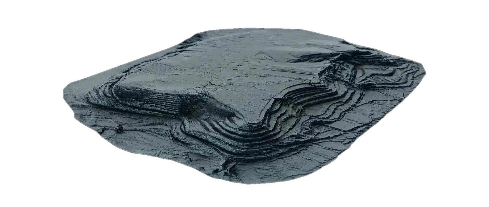
LiDAR Terrain Model for Luxury Estate
A large luxury farm estate near Kamshet in India required a precise 3D terrain model as the base for six separate buildings, roads and landscape. An external LiDAR specialist converted several billion survey points into a single, design-ready terrain surface.
Role: External geospatial specialist — LiDAR to design-ready terrain model
View Case Study →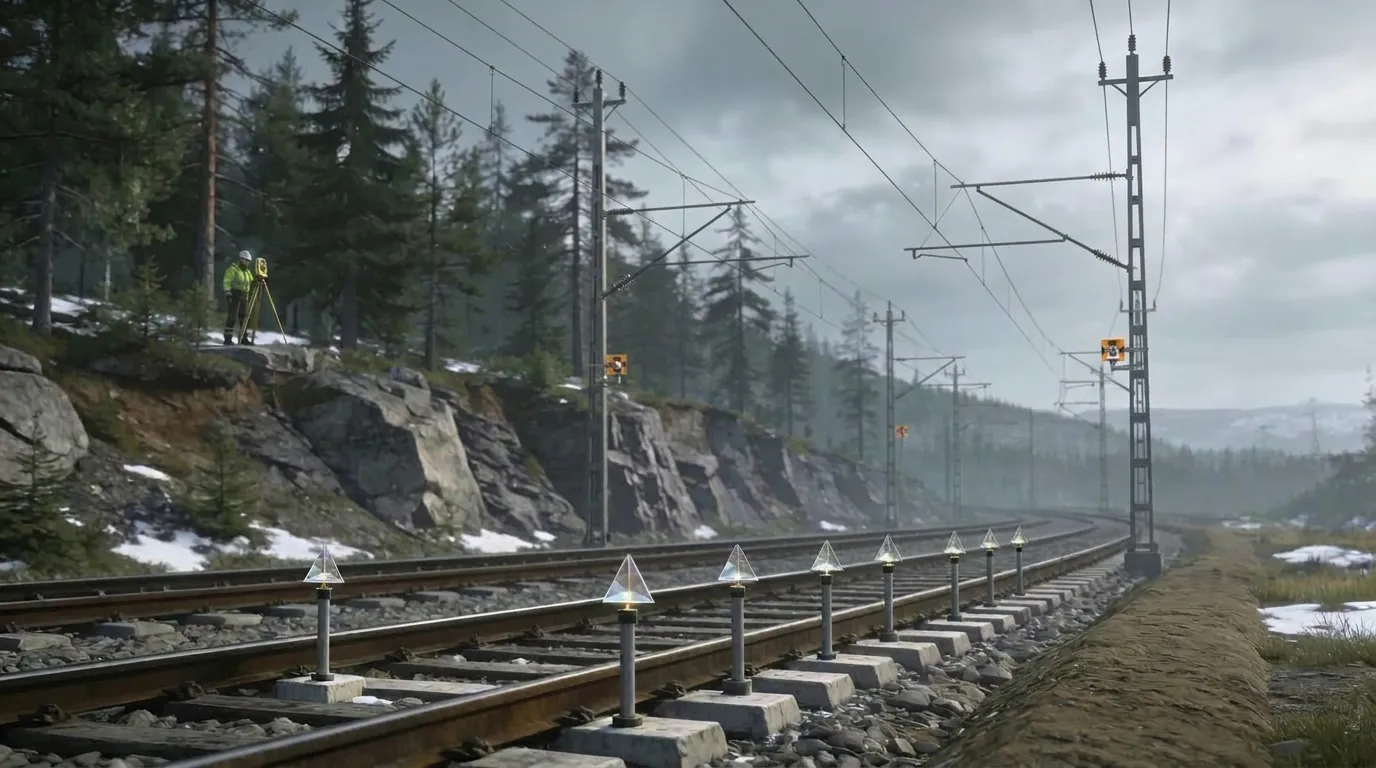
Railway Settlement Monitoring – Norway
On several major Norwegian railway corridors, I provided independent settlement monitoring and dimensional control during complex construction works. Using high-precision GNSS, levelling and structured benchmarks, I tracked rail movements and delivered clear reports that supported safe operations and compliance with national standards.
Role: Land surveyor providing settlement monitoring and dimensional control
View Case Study →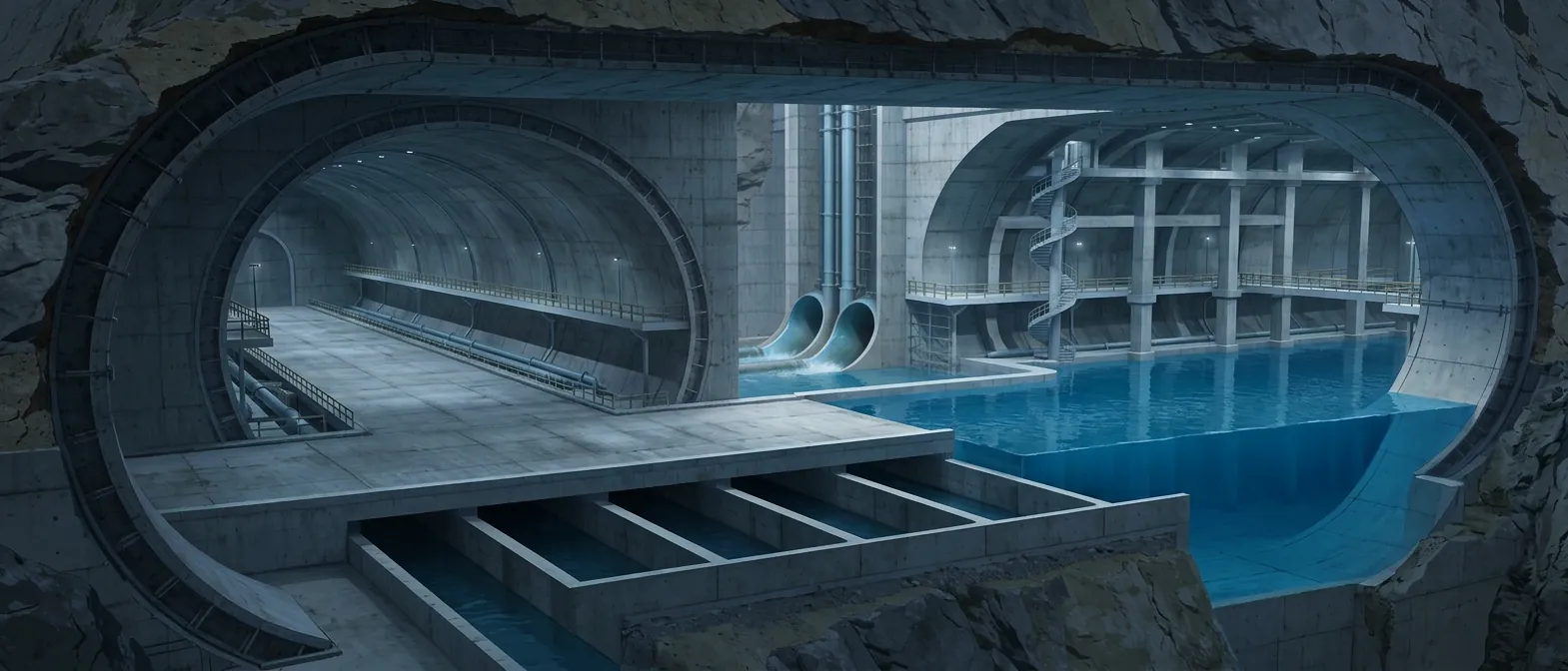
Dimensional Control for Wastewater Tunnel & Treatment Plant
For complex projects such as the Bekkelaget wastewater treatment plant and VEAS Slamsilotunnelen in Norway, I provided end-to-end surveying and dimensional control services. By combining precise setting-out, laser scanning and systematic QC, I helped keep critical structures within tolerance.
Role: Surveying manager / land surveyor responsible for all site surveying and QC
View Case Study →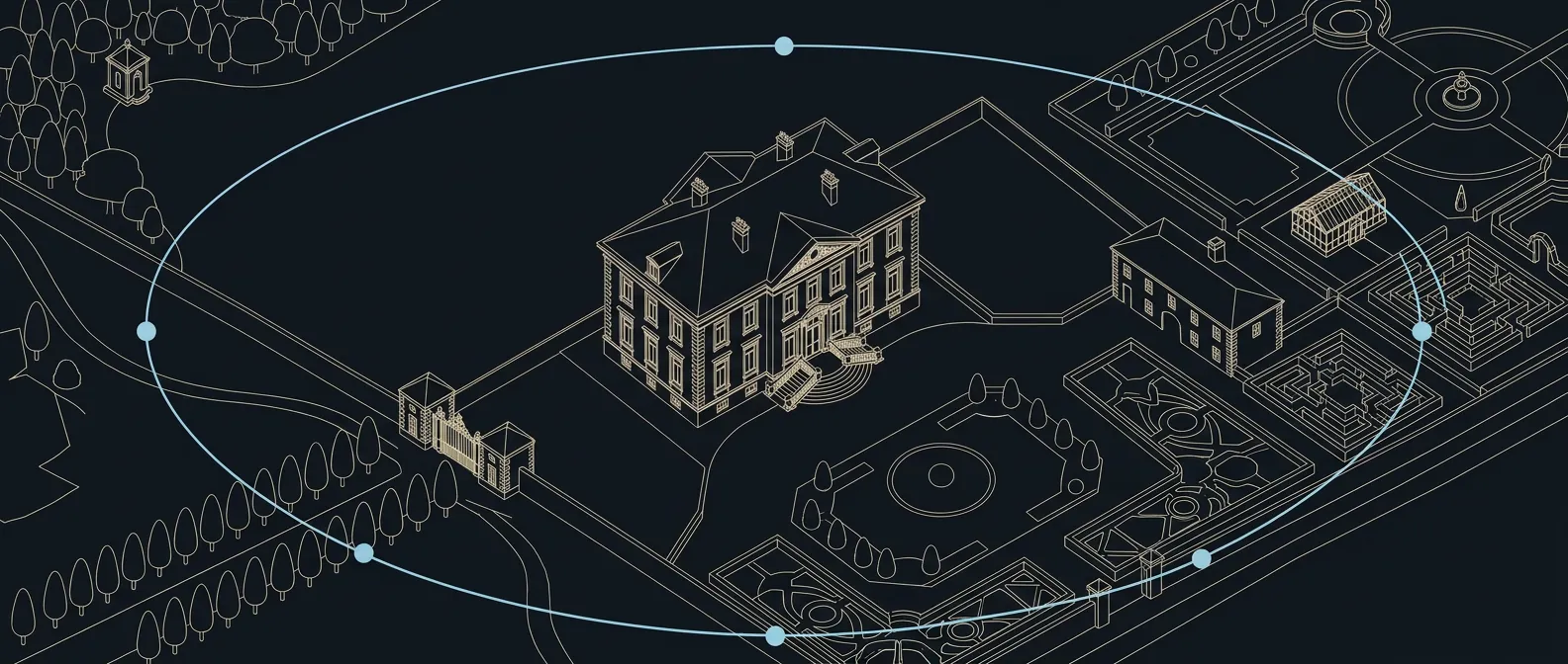
High-Precision Facade Scanning – Embassy of South Africa, Oslo
For an urgent restoration project at the Embassy of South Africa in Oslo, I captured the full outer facade in 3D under tight time and site constraints. Using terrestrial laser scanning and robust registration workflows, I delivered a georeferenced point cloud in RCS/RCP format.
Role: Project lead for scanning, registration and QA
View Case Study →Serving the UAE and Saudi Arabia
Dubai · Abu Dhabi · Riyadh · Jeddah · Eastern Province
From our base in Dubai we deliver 3D laser scanning, LiDAR surveys, point cloud processing and dimensional control for construction and infrastructure projects in Dubai, Abu Dhabi, Riyadh, Jeddah and the Eastern Province. Site capture is arranged with trusted local survey partners, while processing, modelling and quality control stay with us, so every project gets the same senior oversight.
Because our processing workflows are fully remote, we also support clients across the wider GCC. Send us raw scan or survey data from anywhere in the region and receive registered point clouds, terrain models, scan to BIM deliverables and clear QC reports, without the cost of mobilising a full team.
Ready to discuss your project?
Get in touch and we'll respond as quickly as possible on business days. For immediate enquiries, WhatsApp is the fastest channel.
Typical response time: within one business day.